

EN – IN ENGLISH


In 2026 the training package will be available from 1st of February to 10th of August.
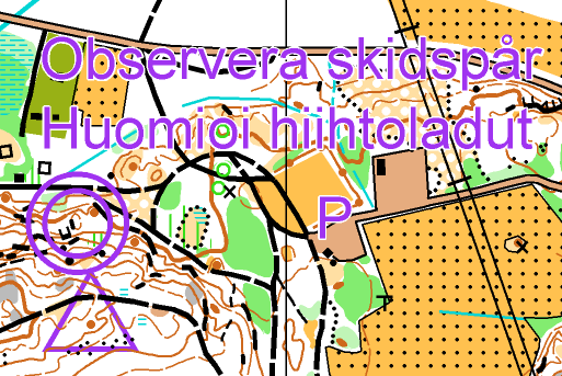
Note! Hunting season is 15th of August to 31st of January in Åland. Training maps are not available under this period of time.
Are you planning a training camp in Åland in 2026? Eleven different trainings offers perfect camp program both to clubs and smaller groups or individual orienteers.
Please contact Anton: anton.kuukka@gmail.com
Instagram: orientera_aland
Below is a table with the dates of the OL-Cup (small competitions with emit + control flags), see more information on the nyheter-pages.
| Date | Competition | Organizer |
| 16.4.2026 | OL-Cup 1 (ÅM-Medel) | IFK Mariehamn |
| 16.5.2026 | OL-Cup 2 (ÅM-Ultra lång) | LUIA |
| 28.5.2026 | OL-Cup 3 | JIK |
| 23.6.2026 | OL-Cup 4 (ÅM-Sprint) | IFK |
| 10.8.2026 | Training package no longer available – hunting season begins | |
| 14.8.2026 | OL- Cup 5 (ÅM-Lång) | LUIA |
| 2.10.2026 | OL-Cup 6 (ÅM-Natt) | IFFK/IFF |
Ordering the maps
Please, order the maps via email: anton.kuukka@gmail.com or in omaps.io webshop.
Prices
| The number of maps | Price of a map |
| 1-29 | 8,50 € |
| 30-59 | 8,00 € |
| 60 → | 7,50 € |
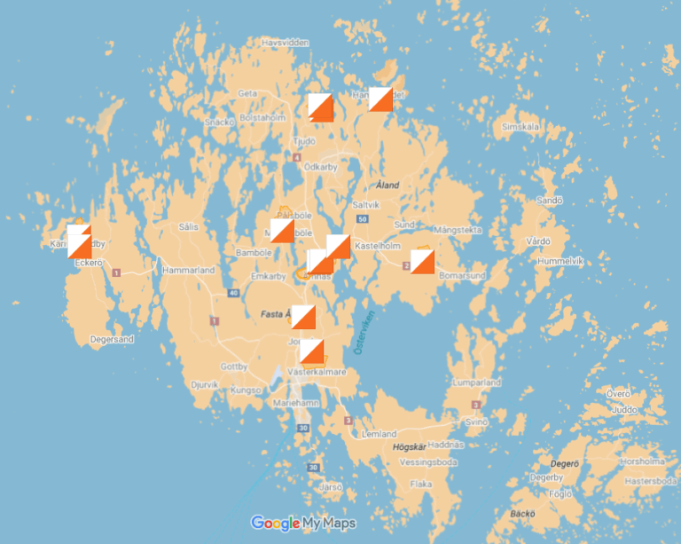
Trainings 2026
| ID | Terrain | Theme | Map (updated) | Controls |
| 1 | Spirberget | Relay | 2020-2021 M. Virtala | Faric ribbon with code |
| 2 | Färjsundet | Middle distance | 2020-2021 M. Virtala (2024) | Faric ribbon with code |
| 3 | Kasberget | Long distance | 2024-2025 M. Virtala | Faric ribbon with code |
| 4 | Käringsund | Relay | 2024-2025 Kuukka & Jalava (new part) | Faric ribbon with code |
| 5 | Käringsund | Middle distance | 2024-2025 Kuukka & Jalava | Faric ribbon with code |
| 6 | Käringsund | Control picking | 2024-2025 Kuukka & Jalava (new part) | Faric ribbon with code |
| 7 | Ingbyberget | Relay intervals | 2025 Kuukka & Jalava (new) | Faric ribbon with code |
| 8 | Pettböle | Middle distance | 2024-2025 Kuukka & Jalava (new part) | Small flag with code |
| 9 | Hamnsundet | Middle distance | 2021 A. Kuukka (2024) | Plastic tube |
| 10 | Markusböle | Long distance | 2021 A. Kuukka (2024) | Plastic tube |
| 11 | Finby | Masstart | 2024 A. Kuukka | Plastic tube |

Please contact Anton if you have any questions: anton.kuukka@gmail.com

Please, ask more information if you need: anton.kuukka@gmail.com
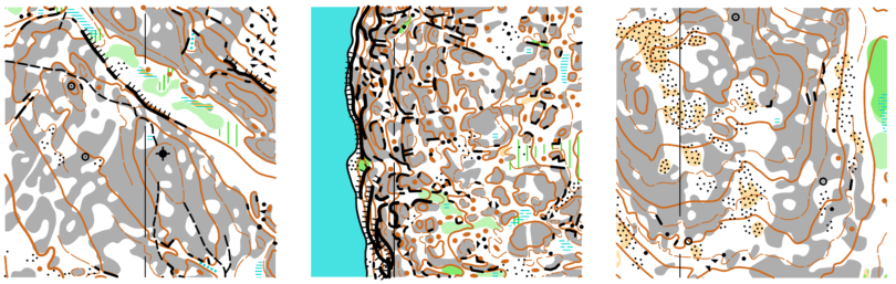
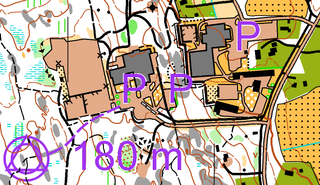
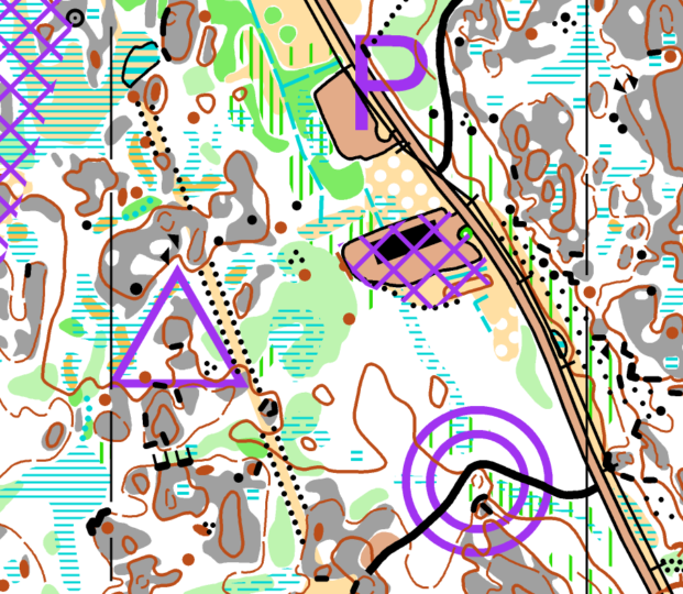
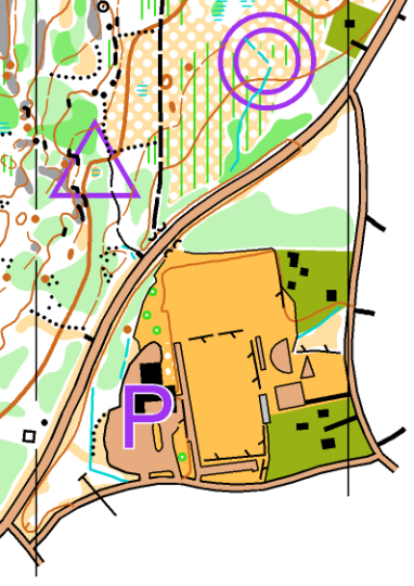
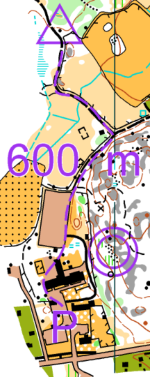
#1 SPIRBERGET relay (2026)
| Course | Length | Level of difficulty | 1:7 500 | 1:10 000 |
| A | 8.7 km | Black | X (A3) | X (A4) |
| B | 6.9 km | Black | X (A4) | X (A4) |
| C | 3,9 km | Red | X (A4) | X (A4) |
| D | 2.3 km | Yellow | X (A5) | X (A5) |
Relay training in the Spirberget terrain. The A and B course are long and demanding courses that traverses the most detailed slope areas.
The D course is based around nearby powerlines. All the courses have forking.
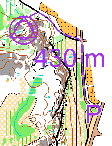
Parking (Godby Upper Secondary School)
Mapping: (2020-2021) Markku Virtala (2.4 km²).
#2 FÄRJSUNDET middle distance (2026)
| Course | Length | Level of difficulty | 1:7 500 | 1:10 000 |
| A | 5.0 km | Black | X (A4) | X (A4) |
| B | 3.6 km | Black | X (A4) | X (A4) |
| C | 1.9 km | Yellow | X (A5) | X (A5) |
Middle distance training in the Färjsundet terrain.
Located in the northern part of the Gibbölebergen map. The course offers a challenging control-picking focused experience.
Mapping (2020-2021) Markku Virtala / Updating (2024) Anton Kuukka (1.1 km²).
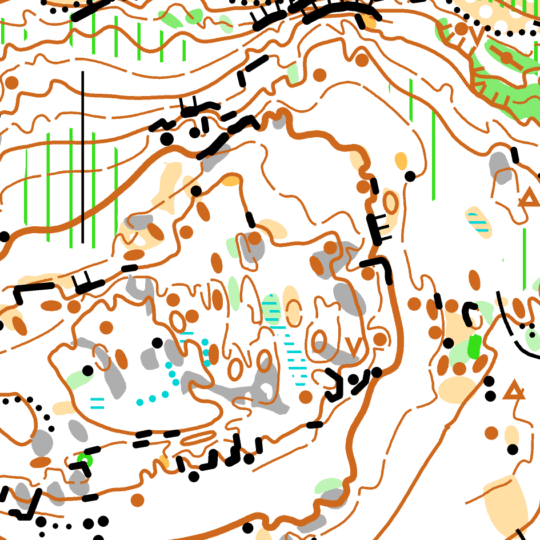
#3 KASBERGET långdistans (2026)
| Course | Length | Level of difficulty | 1:7 500 | 1:10 000 | 1:15 000 |
| A | 10.7 km | Black | X (A3) | X (A4) | |
| B | 7.4 km | Black | X (A3) | X (A4) | |
| C | 4.6 km | Red | X (A4) | X (A4) | |
| D | 2.8 km | Yellow | X (A4) | X (A5) |
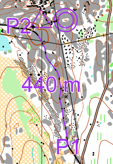
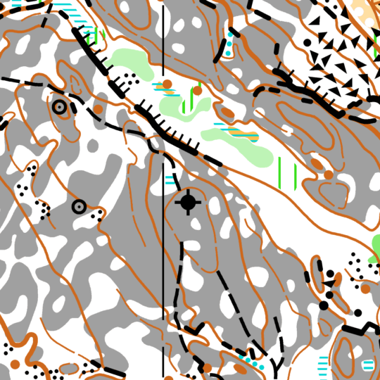
Long distance training on the new Kasberget map.
The A course visits the new Narmoberget area in the east.
Parking: Åland skiing and biathlon center.
Mapping (2023–2025): Markku Virtala (2.5 km²).
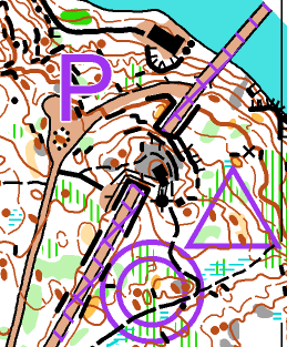
#4-6 KÄRINGSUND relay, middle & control picking (2026)
| Course | Length | Level of difficulty | 1:7 500 | 1:10 000 |
| Relay A | 7,1 km | Blue | X | X |
| Relay B | 3,9 km | Red | X | X |
| Middle A | 3,9 km | Orange | X | X |
| Middle B | 2,8 km | Yellow | X | X |
| Control picking | 8,3 km | Blue | X | X |
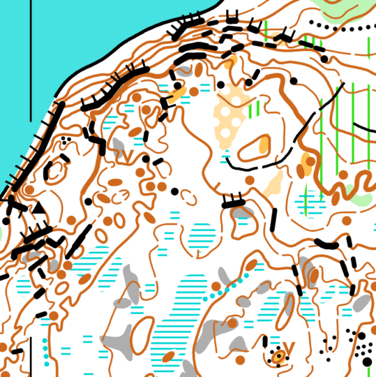
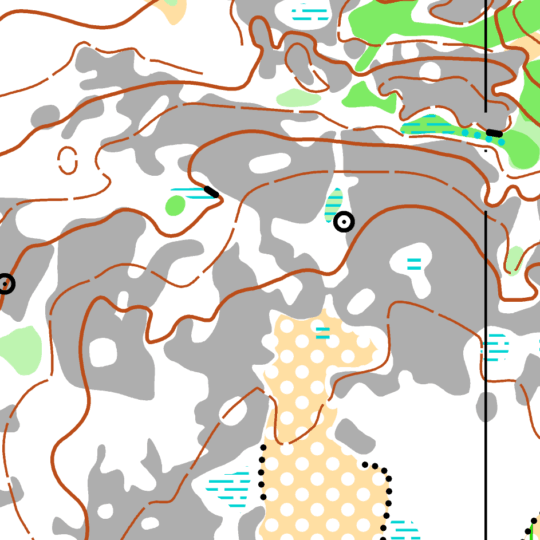
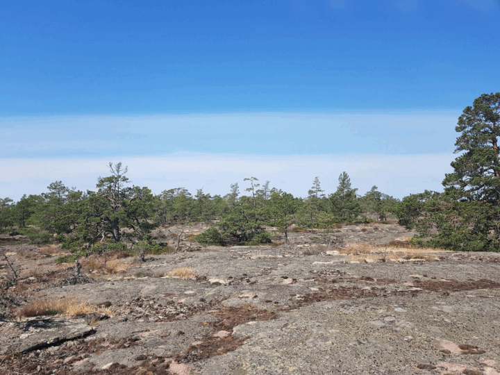
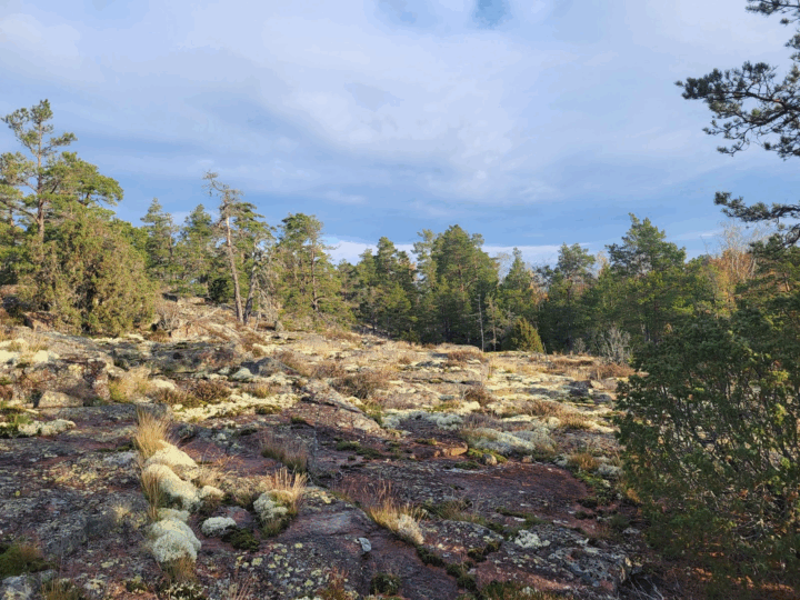
The Käringsund terrain is flat and easy-to-run with a 2.5 meter contour interval. The map has been expanded for the training package, now reaching all the way to the seashore. Welcome to Finland’s westernmost orienteering map!
The relay, middle and control-picking trainings use same control points, so please keep this in mind when ordering maps.
Parking: Eckerö Träsket’s nature trail.
An alternative parking place if the first one is full.
Mapping (2024–2025): Anton Kuukka, Enni Jalava & Elias Kuukka (2.2 km²).

#7 INGBYBERGET relay intervals (2026)
| Course | Length | Level of difficulty | 1:7 500 | 1:10 000 |
| A | 5.3 km | Black | X | X |
| B | 3.1 km | Black | X | X |
| C | 2.8 km | Red | X | X |
| D | 2,2 km | Yellow | X | X |
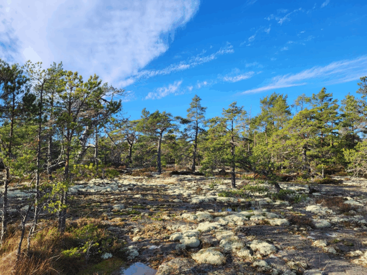
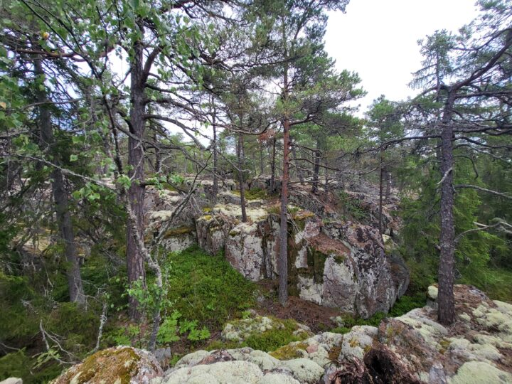
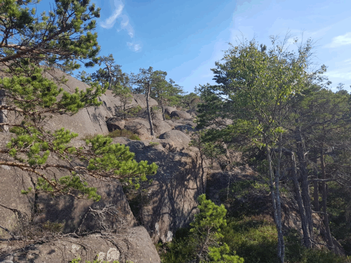
Orienteering intervals with relay forkings on the new Ingbyberget map. Ingbyberget is one of the Åland’s most popular nature destinations. There is an 11-metre-deep, an 11-metre-deep cave-like crevice, Bronze Age burial mounds and one of Åland’s many ancient shorelines with a shingle beach formed about 7,000 years ago. In the top of Ingbyberget, there is also a lookout tower where you can admire the scenery during or after your training.
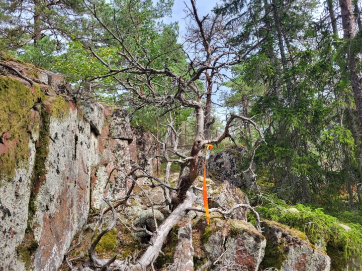
Control points are marked with fabric ribbon and code tags.
Parking: Ingbybergen
Map: (2025) mapped by Enni Jalava, Elias Kuukka & Anton Kuukka (1.4 km²).
#8 PETTBÖLE middle distance (2026)
| Course | Length | Level of difficulty | 1:7 500 (A4) | 1:10 000 (A4) |
| A | 6.0 km | Black | X | X |
| B | 4.7 km | Black | X | X |
| C | 3.8 km | Orange | X | X |
| D | 2.0 km | Yellow | X | X |
Middle-distance training in the easy-runnable bare rock terrain of Pettböle.
Controls are marked with small control flags.
Parking (You can also park further in, at the base of the first wind turbine)
Map (2024–2025) mapped by Elias Kuukka, Enni Jalava & Anton Kuukka (2.0 km²).
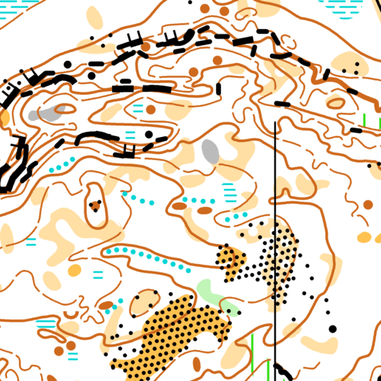
#9 HAMNSUNDET middle distance (2025-2026)

| Course | Length | Level of difficulty | 1:7 500 | 1:10 000 |
| A | 5.2 km | Black | X | X |
| B | 4.5 km | Black | X | X |
| C | 3.9 km | Red | X | X |
| D | 2,4 km | Red | X | X |
Hamnsundet middle distance is the most technically demanding training of this year’s training package. A and B courses are the same, but B course have a little shortcut in the end. The C and D courses were planned to rely on the power line, but now in March 2026 the power line has been dismantled, and those courses are more challenging (difficulty level red).
The western part of the map is made by Anton Kuukka in 2021, but it’s updated in autumn of 2024.
Plastic tubes in controls.
Note! This training was part of the 2025 training package but it is available also in season 2026.
Parking: Municipality’s parking place
#10 MARKUSBÖLE long distance (2025-2026)
| Course | Length | Level of difficulty | 1:7 500 (A4) | 1:10 000 (A4) | 1:15 000 (A4) |
| A | 8.9 km | Black | X | X | |
| B | 6.9 km | Black | X | X | |
| C | 5.6 km | Black | X | X | |
| D | 4.2 km | Orange | X | X |
In Markusböle there’s a hill called Storberget which rises over 60 metres above the surroundings. Åland 2-dagars competitions were held there in 2024.
You can pay attention to long legs, route choices and straightforwardness in this long distance training.
The map is made in 2021 and updated in 2024.
Plastic tubes in controls.
Note! This training was part of the 2025 training package but it is available also in season 2026.
Parking Markusböle’s sport field
#11 FINBY masstart (2025-2026)
| Course | Length | Level of difficulty | 1:7 500 (A4) | 1:10 000 (A4) |
| A | 6.8 km | Black | X | X |
| B | 5.5 km | Black | X | X |
Masstart training with diamond forking. Excellent opportunity to train first leg running and other relay situations.
Map is new (2024) made by Anton Kuukka.
Plastic tubes in controls.
Note! This training was part of the 2025 training package but it is available also in season 2026.
Parking: Sund’s school
Archive: